The Executive Summary text was extracted from the Nomination Dossier for the Bač Cultural Landscape entry on the UNESCO World Heritage List of Cultural and Natural Heritage, submitted on January 28th 2022 at the UNESCO World Heritage Centre in Paris.
Executive Summary
State Party
Republic of Serbia
State, Province or Region
Republic of Serbia, Autonomous Province of Vojvodina, The South Bačka District
Name of Property
Bač Cultural Landscape
Geographical coordinates to the nearest second
45⁰ 23′10.6″ N – 19⁰ 8′ 49.5″ E
Textual description of the boundary(ies) of the nominated property
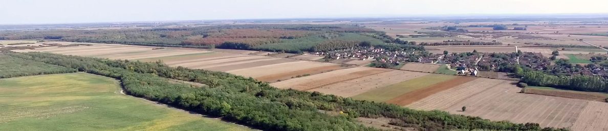
The Bač Cultural Landscape is located in the south of the Pannonian Plain, in the Republic of Serbia, the Autonomous Province of Vojvodina. In Vojvodina, it is the far south-west region, Bačka, obviously owing its name to Bač, the focal point of the landscape.
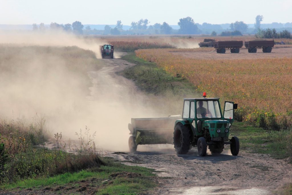
The major part of the Bač Cultural Landscape is in the Bač Municipality, covering the south-west line of the Odžaci and the south-west line of the Bačka Palanka municipalities. The area of the Bač Cultural Landscape covers 460.27 sq. m, and there are 7 settlements with the population of about 20,000 (the 2011 national census), with an exceptionally multicultural and multiconfessional structure, whose dominant activity is agriculture.
The Bač Cultural Landscape belongs to the Danube Basin, about in its mid-course that runs through 10 European countries. In its way through Serbia 588 km long, the Danube goes from the tristate border of Serbia, Hungary and Croatia to the confluence with the Timok River on the tri-state border of Serbia, Bulgaria and Romania. The Danube flows along a picturesque Vojvodina plain and the “Bačko Podunavlje” Biosphere Reserve, “Fruška Gora” National Park and “Đerdap” Geopark. Its major tributaries in Serbia are the Tisa, Sava, Tamiš, Morava, Pek and Timok rivers. Its left tributary, the Mostonga, which flows along the Danube old course, exactly like the Živa and Vajiš rivers, is very important for the Bač Cultural Landscape.
The Bač Cultural Landscape southern eastern and partly northern border is the Danube, while the Republic of Croatia lies on its other side. At one point, the northern border leaves the Danube and runs along the Bogojevo-Odžaci canal that connects the Danube with Mostonga in one of the meanders. Thence, the eastern border goes along, which naturally defines, following the Mostonga valley or the higher river terrace edge, but also covers some archaeological sites that lie along the border. Then the border runs along the western side of the Karavukovo village, including Deronje, and goes on between Bač and Selenča village, including Mladenovo settlement. In the south-east of Mladenovo, the border meets the Danube again, following the settlements’ area roads, embankments and cadastre parcel lines (a detailed description of the entire border by cadastre parcels is given in map 4).
Criteria under which property is nominated (itemize criteria)
ii, iii, v
Draft Statement of Outstanding Universal Value
Brief description:
The Bač Cultural Landscape is part of the south outskirt of the Pannonian Basin, defined naturally by the Danube and surrounded by its previous and present course. Continuous settlement can be traced on this terraced terrain, abundant in water, fertile land, and vegetation, leading to exceptional cultural diversity, as witnessed by its richness in tangible and intangible heritage. Life and economy rely on land and water use by different human communities in this area and last from the early Neolithic until the present day, covering more than 8,000 years. In our age (from the beginning of the first millennium – Common Era), this area was an important border region and the crossroads between civilizations that shaped it culturally and economically.
At the center of our cultural landscape is the town of Bač (Bache, Baacs, Baach, Bács), the administrative, religious and cultural center of the whole area. The name of the region in Vojvodina – Bačka, where the Bač Cultural Landscape is located – is derived from its name and represents a Slavic noun-form with the suffix “ka”, later accepted and adopted in German and Hungarian, referring to the vast territory between the rivers Danube and Tisa, spreading across to countries today: Serbia and Hungary.
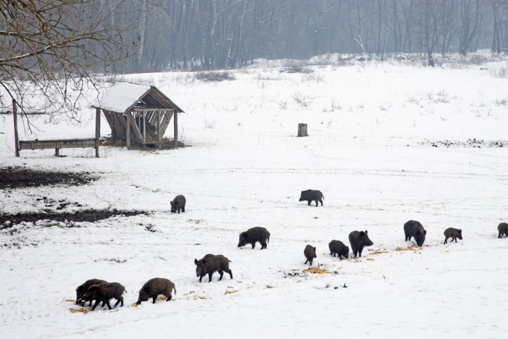
The Bač Cultural Landscape encompasses the terraced flatland territory between the Danube and the southernmost part of its confluent Mostonga. This is the area between riverbanks and upper river terraces where human communities settled, characterized by altitude differences inferior to 10 meters. The geologic structure of this landscape, apparently simple, is composed of the Danube sediments covered in fine Aeolic dust, which made it exceptionally fertile. At the same time, it is a landscape with an abundance of surface and underground waters and watercourses, above all the Danube and the channeled courses of the Mostonga, Živa, Berava and Vaiša rivers. From their arrival to these territories that can be traced from the 7th millennium BC, human communities managed and controlled its abundant watercourses, adapting to the unpredictable nature of rivers. They started processing and cultivating the land they lived on reasonably early. Since the land maintained its fertility for a long time due to its specific characteristics, they did not need to change their habitat. This created an unbreakable bond between man and his natural environment, preserved in the Bač Cultural Landscape until the present day, with certain changes in modern times. The most significant part of the 350 archaeological sites in this area testify of the richness and diversity of life on these territories.
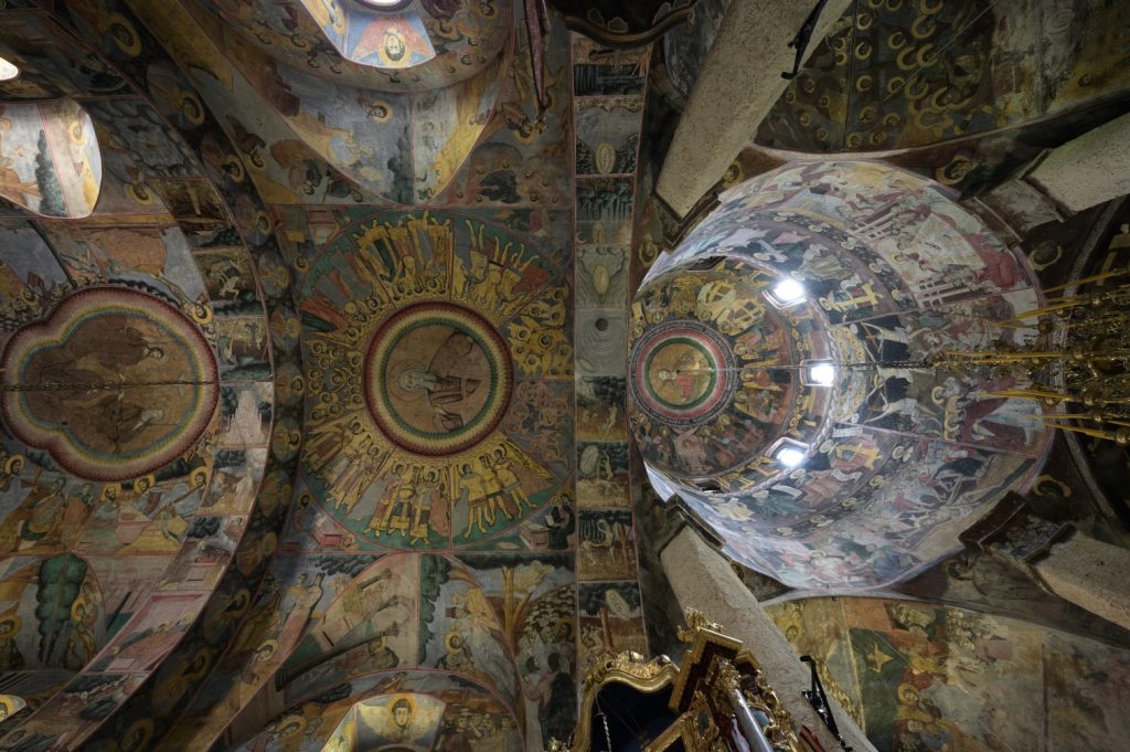
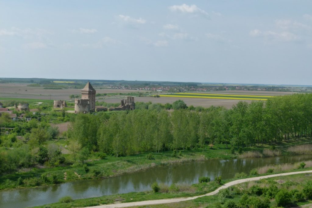
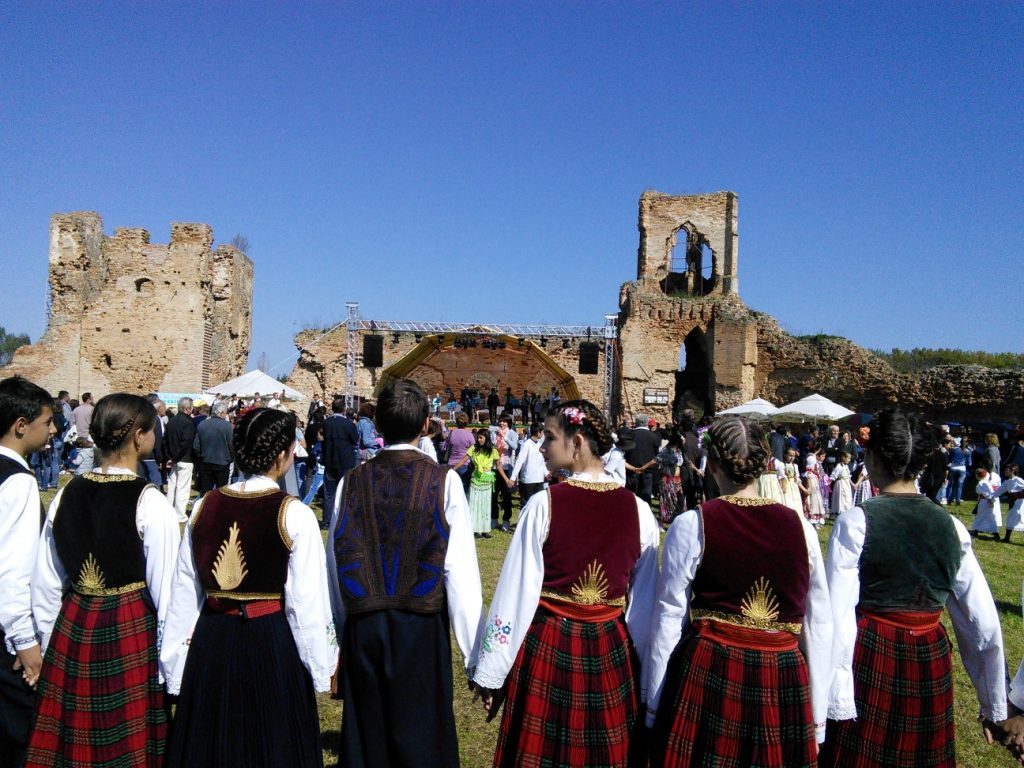
When the area around Bač became the border region of the Roman Empire, more precisely of its Danube border – so-called Counter Limes – at the turn of the Common Era, its role in history gained significance. Previously, this area was the crossroads leading south from Central Europe towards the Mediterranean and further towards Asia and back. Still, from antiquity it became a clashing and meeting point for different civilizations, first of all between indigenous and Roman, then between Byzantine and Western European and finally between Ottoman and Christian. Historical and archaeological evidence testify to this, but preserved monuments, such as the Bač Fortress, the Franciscan Monastery and the Bođani Orthodox Monastery. Their hybrid character, expressed through a mixture of artistic influences and styles, testifies to the exchange of cultural and creative models. Its preserved diversity is embodied in a pronounced multi-ethnicity, various-confessionalism, and transculturality.
Criterion (ii)
The Bač Cultural Landscape is an area with specific natural characteristics preserving clear testimony of the exchange of different cultural models over several millennia. Its unique border position, intersected by essential water and land routes, contributed, along with its population, deeply connected with its natural environment. The remains of the medieval fortified city of Bač destroyed and rebuilt using various architectural styles, the Franciscan Monastery, and Bođani Orthodox Monastery, along with the remains of the hammam from the Ottoman period, are all examples of intertwining between diverse cultural influences, rarely found in one place.
Criterion (iii)
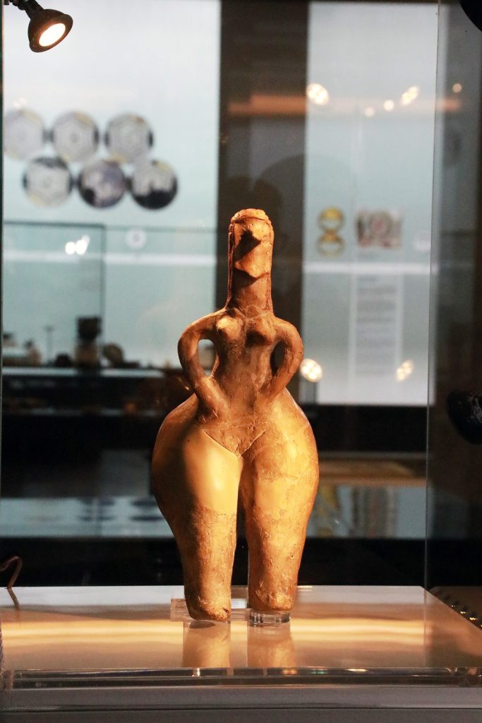
Three hundred and fifty archaeological sites have been identified on the small area of the Bač Cultural Landscape until today. Some of the oldest belonging to sedentary cultures that found their permanent habitat in Europe, moving from the Asian Eastern Mediterranean. These first Neolithic inhabitants in this naturally protected landscape brought with them the seeds of the first cereals, the first livestock, and established a specific lifestyle that will be based on early agriculture and farming, on gathering, hunting and fishing, which has been preserved until the present day in some of its manifestations. Judging by the recovered artefacts, especially on Donja Branjevina, the culture they developed shows the high artistic aspirations and exceptional skill of its oldest creators.
Criterion (v)
The Bač Cultural Landscape is the region where, in processes of river erosion and accumulation, the meandering Danube incised one of its banks while it deposited materials carried by its waters on the other. This created a flatland, while in reality, it is a wavy terrain with slight altitude differences, particularly suitable for the development of diverse plant and animal species and human life. Because of its natural characteristics, soil diversity and the abundance of underground and surface water, the area of Bač is a unique location for life. The specific use of different types of soil, wood and water resources and the way of life and economy allowed for the same characteristics to be preserved from prehistory to the present day. This singularity is further accentuated by the exceptional communication potential of the landscape, located on the route between Central and Southeastern Europe, where natural conditions allowing the crossing of the Danube provided a connection with neighboring regions – Srem and Slavonia.
Declarationofintegrity
The Bač Cultural Landscape is characterized by exceptional diversity in natural and cultural characteristics and also by a preserved continuity in life and economy over several millennia. This does not mean that its inhabitants are not in touch with the modern way of life. Still, the traditions of gathering, fishing, hunting, agriculture, and farming remained dominant in this area until today. There is a high level of uniformity between elements that define the landscape: large plots of arable land and pastures, woods, watercourses and water surfaces, traditional farmsteads (salaši) and villages preserving their visual identity. The whole landscape is still dependent on agriculture and water use, while natural reserves have been well maintained. Industrial facilities are rare and involved mainly in food processing. Road networks are underdeveloped and based on routes defined in the past; since starting with the 19th century, the area has lost its transitional character. Presently, it seems that the Bač Cultural Landscape is not under direct infrastructural and developmental pressure and that it is not under immediate threat, but future developmental activities that could influence the integrity of the landscape should be closely monitored.
Declaration of authenticity
The Bač Cultural Landscape is a trustworthy testimony of historical, cultural, and socio-economic processes that played out on its territory through the gradual evolution of the landscape to increase its productivity. The current appearance of the landscape is still characterized by a strong bond with its past appearance, and its recognizable features in the flatland still safeguard its most important historical buildings, such as Bač Fortress and the Franciscan Monastery. Conservation interventions on cultural and natural resources are implemented carefully, and they are preceded by detailed and extensive analysis. It seems that there are no visible threats that could influence the authenticity of the cultural landscape as a whole or its elements.
Information on protection and management
Protection and management of the Bač Cultural Landscape are regulated by numerous international conventions, national legal framework and numerous planning and strategic documents. Public institutions continuously implement protection and maintenance measures determined by specific laws and regulations. Numerous cultural monuments within the Bač Cultural Landscape and their official valorization and registration, along with preventive works on their protection, conservation, and presentation, are under the supervision of the Republic Institute for the Protection of Cultural Monuments of Serbia and the Provincial Institute for the Protection of Cultural Monuments of Vojvodina. Protected natural resources are subject to valorization, management, and registration and protection system establishment by the Provincial Institute for Nature Conservation, while management of natural reserves falls within the competence of public companies “Vojvodinašume” and “Vode Vojvodine”. Significantly, the whole area of the Bač Cultural Landscape is part of the biosphere reserve “Bačko Podunavlje”, enrolled in the UNESCO program Man and Biosphere 2018. The Provincial Secretariat for urbanism is in charge of planning, supervising and implementing spatial plans for particular areas. The Special Purpose Area Plan for the Bač Cultural Landscape, adopted in 2015, is especially relevant. The Management Plan for the Bač Cultural Landscape has been produced in addition to the legal framework and numerous planning and strategic documents that clearly define specific areas in the cultural landscape management. This Plan integrates all legal and strategic aspects and foresees particular management models and goals for the Bač Cultural Landscape. In defining the management model, the Management Plan relies heavily on pre-existing institutional and civil cooperation networks, created over more than a decade of work on the cultural area platform called “Centuries of Bač”. Recognized roles, specific responsibilities, cooperation, and communication channels between interested parties were crucial in creating the most appropriate management model and organizational framework. To protect, care, improve and use the Bač Cultural Landscape sustainably, the Provincial Institute for the Protection of Cultural Monuments with headquarters in Novi Sad formed an independent legal body following consultations with all stakeholders – the Provincial Institute for the Protection of Cultural Monuments’ Foundation for the management of the Bač Cultural Landscape.
Name and contact information of official local institution/agency
The nomination file for Bač Cultural Lanscape was made in cooperation between Republic and Provincial Institutes for Protection of Cultural Monuments in Belgrade and Novi Sad.
| Organization: Republic Institute for Protection of Cultural Monuments Address: Radoslava Grujića str, 11, Belgrade Tel: +381 11 24 54 786 Fax: +381 11 34 41 430 E-mail: sekretarijat@heritage.gov.rs Web address: www.heritage.gov.rs | Organization: Provincial Institute for Protection of Cultural Monuments Address: Štrosmajerova str, 22, Petrovaradin, Novi Sad Tel: +381 21 43 12 11 Fax: +381 21 64 32 576 E-mail: office@pzzzsk.rs Web address: www.pzzzsk.rs |